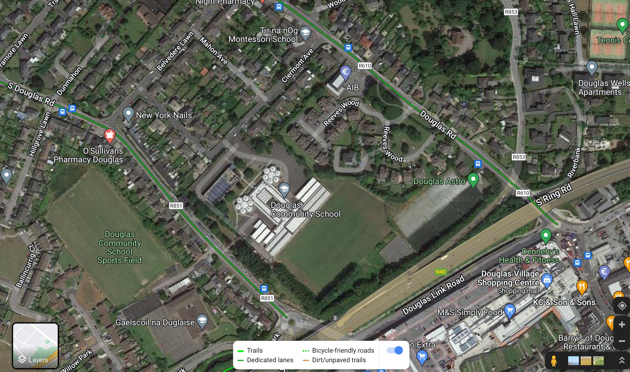
Getting to DCS
DCS is located in the heart of Douglas, conveniently accessed off the South Link Road and bordering the South Douglas Road/Clermont Avenue. It is currently served by the 206, 207 and 219 bus routes with dedicated cycling lanes on the main and south Douglas roads. (See attached map)
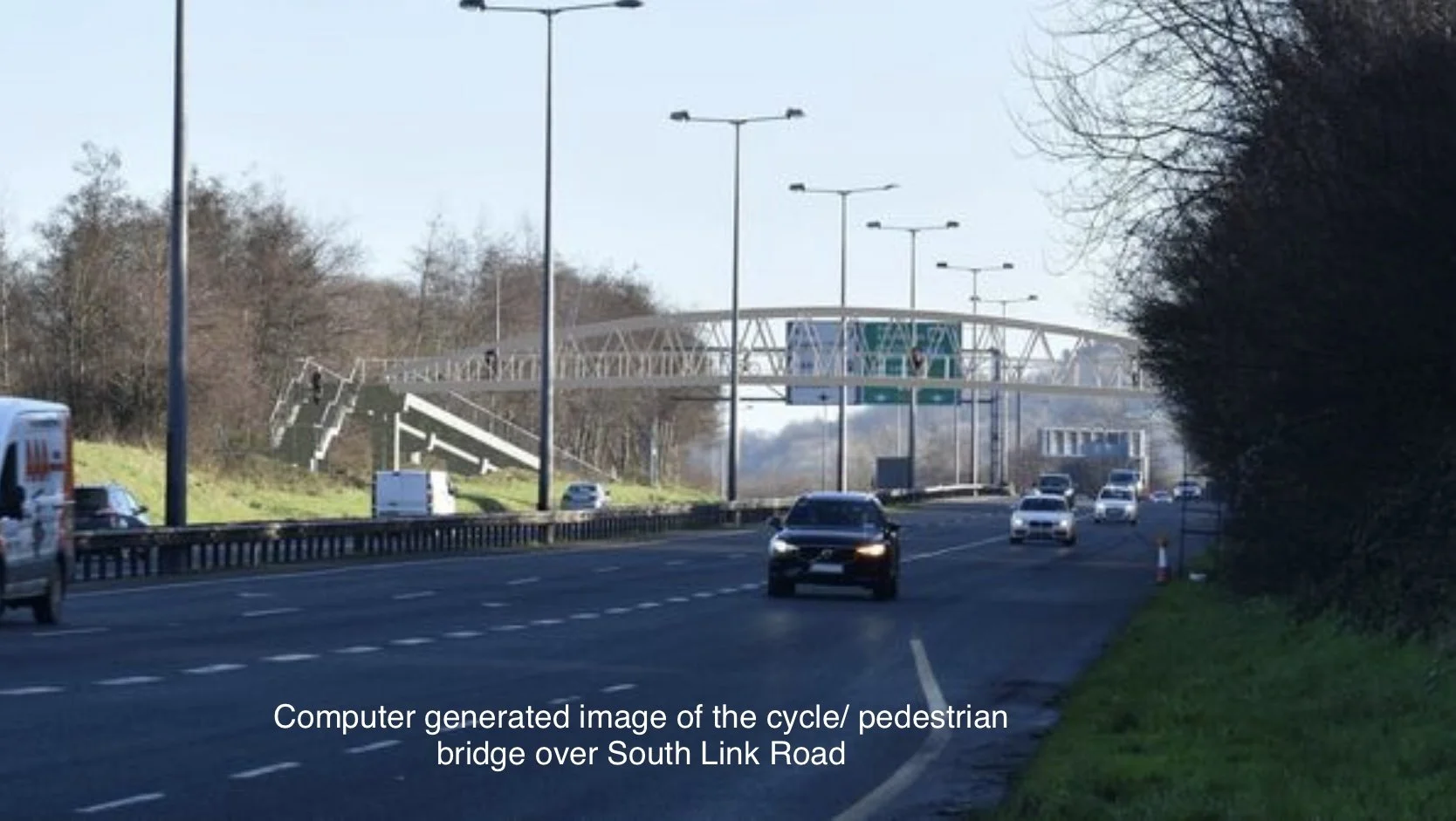
New Frankfield/Grange Pedestrian and Cycle Lane
Firstly, work has finally begun on the long awaited pedestrian and cycle link over the N40 motorway between Grange/Frankfield and Tramore Valley Park. The link provides a sustainable travel route, allowing DCS students the option to safely walk or cycle from Grange/Frankfield to Tramore Valley Park and then on to Douglas Community School on the South Douglas Road.
This should reduce traffic congestion and reduce dependency on cars for travel for DCS students. It also gives everyone the opportunity to easily and safely enjoy a more active lifestyle.

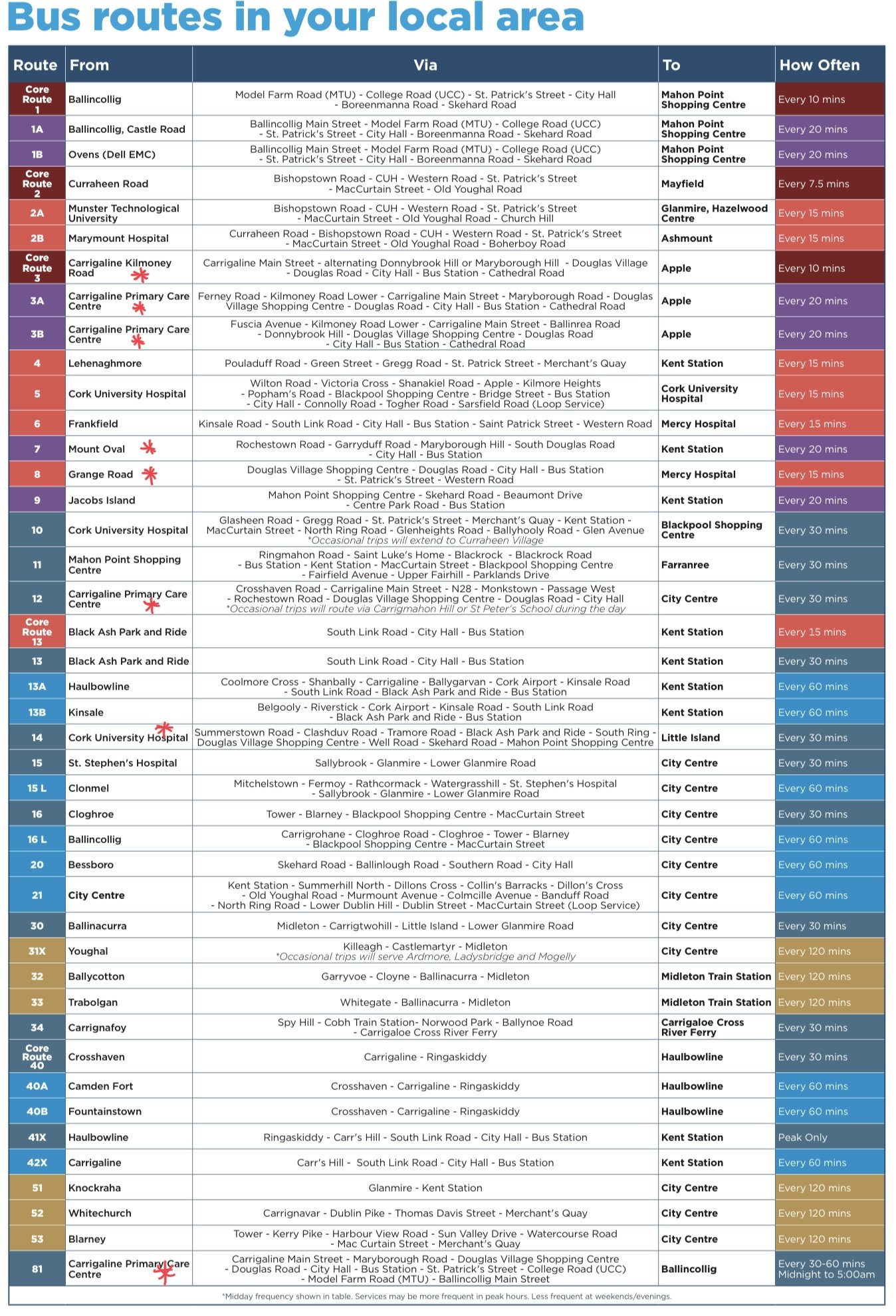
Proposed New Bus Routes
For students travelling from further afield to DCS, the proposed new bus routes will improve access from Crosshaven, Carrigaline and Rochestown with a more frequent service running down Donnybrook Hill. These new routes must go through another round of consultation before being finalised and rolled out in 2023.
An interactive map with the new routes can be accessed by clicking on the following link